

Before that, the church dedicated to St Mary seems to have been up on Banc Du. We don't know who built it, or when — but it was probably erected by a wealthy patron some time after the establishment of the Barony of Cemais. It was recorded as a "chapel of ease” connected to Nevern Church in 1284, but it may have been used mainly for private worship. Was it built of wood, or stone? Was it destroyed and rebuilt in this exposed and vulnerable place during the centuries of conflict between the Anglo-Normans and the Welsh princes? Maybe over and again? And where exactly was it located? And was it connected in some way to the medieval "deer park" that is known to have existed on Waun Mawn? The old maps show it on the slope of the hill above the old quarry — but Vanya thinks that it might have been located on the flatter ground below the quarry — and there is indeed a very faint rectangular shape there, visible on satellite images, measuring c 15m x 5m, and aligned approx N-S.
Another clue to the existence of this little church or chapel comes in the story of Henry Tudor and his march from Dale to Bosworth Field. In August 1485 he passed this way, and tradition has it that he camped with his growing army at a place called “the fifth milestone”. That might well have been on the plateau near the summit of Cnwc yr Hydd, which is spacious enough and dry enough to accommodate a substantial encampment involving horses, men and their supplies. Tradition also has it that Henry slept at Fagwr Lwyd and that he worshipped at the church of St Mary. Those three locations, within a kilometre of one another, suggest to me that the tradition is a reliable one. The trackway leading down to Garfeth and then onwards to Cilgwyn and Newport is also a very substantial if ruinous lane, and we can speculate that this might well have been the main road leading from Haverfordwest to Newport.
It would be rather exciting if we can establish where this “lost church” was actually located……..
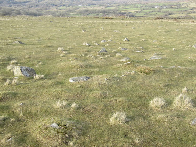
The dolerite plateau to the west of Cnwc yr Hydd summit. Was this the upland meadow on
which Henry's army camped on the night of 8th August 1485?
No comments:
Post a Comment